Coastal engineering and maintenance
Coast engineering at work in Thanet
The Engineering and Technical Services Section is responsible for coastal management along Thanet’s 16 miles of coastline. 11 miles of this coastline is protected by concrete sea walls which protect the land behind from erosion or flooding by the sea. About 85% of the Thanet coastline is at risk from erosion, but some low lying areas are at risk of flooding such as the Old Town area of Margate.
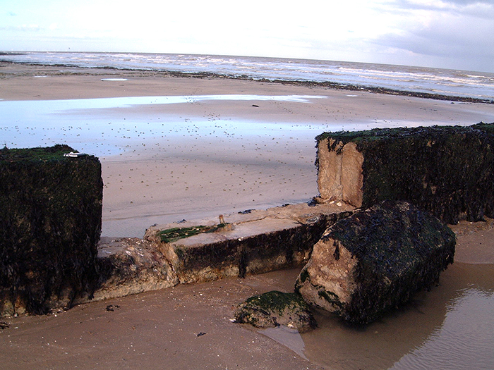
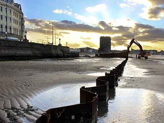
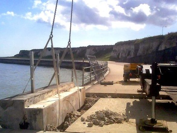
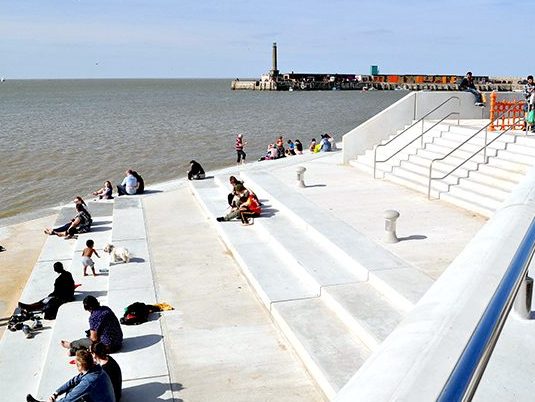
The maintenance of Thanet’s sea walls and promenades is a continuous job particularly in the tidal zone and the Engineering Team carry out programmed inspections to monitor the condition of the structures and identify necessary repair work.
The inter-tidal zone is an extremely harsh environment for engineered structures to exist in and regular maintenance is vital if the full design life of structures is to be realised and where practical exceeded to maximise their whole life value.
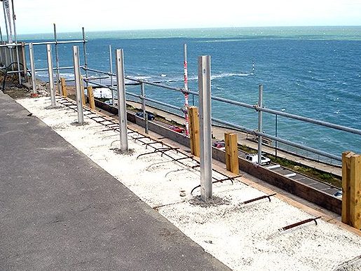

The Engineering Team at Thanet work in partnership with four other Kent Coastal Authorities, these being Canterbury, Dover, Shepway and Swale. The government has recognised the requirement for closer working between local authorities, ensuring a robust identification, implementation and long term management of flood and coastal erosion risk management works. The forming of partnership allows joint working and sharing of resources on major schemes and allows better sharing of local knowledge. Together the 5 engineering teams are called the East Kent Engineering Partnership. More about the partnership can be found by following this link
Permalink
![]()
The South East Coastal Group is the Regional Coastal Group for South East England. The Group brings together local authorities, the Environment Agency and other maritime operating organisations to achieve co-ordinated strategic management of the shoreline between the Isle of Grain and Selsey Bill.
A previous study of the coastlines of England and Wales, for the Ministry of Agriculture, Fisheries and Food (MAFF), established that coastal sediment movements occur within distinct boundaries, or cells, which are rarely coincident with administrative boundaries. Piecemeal coast protection schemes may not always be compatible with coastline needs elsewhere within the same sediment cell. Recognising this fact, the operating authorities decided to produce an integrated coastal defence strategy called a Shoreline Management Plan (SMP) wherein all the conflicting needs and constraints on the coastline are identified and considered.
The Thanet Coastline falls within the Isle of rain to South Foreland Shoreline Management Plan. This is a second generation plan (superseding the original SMP dated 1995) which was approved by the Environment Agency in 2010.
The whole of the Isle of Grain to South Foreland SMP is available to read and download at http://www.se-coastalgroup.org.uk
PermalinkMuch of the Thanet coastline is currently protected by man made defences but in a number of areas the coastline consists of undefended chalk cliffs. These cliffs can be subject to erosion. Coastal change is a natural, ongoing process that has always happened.
As sea water meets cliffs and shores, it causes sediment or rocks to be broken down and washed out to sea. In some instances, this material may be moved to a different part of the coast and deposited in large quantities, causing ‘accretion’ – the opposite of erosion, where shorelines may advance or build up with sediment over time. In fact, the sand and shingle that makes our beaches is a product of erosion, and to remain in place they need a continual supply of material.
Erosion can happen under any conditions, but its rate tends to increase when waves are powerful and water levels are high – for instance during storms or in high winds.
More information on cliff erosion, coastal change and predicted erosion rates can be found on the environment Agency’s website at:
Coastal erosion – https://www.gov.uk/check-plans-to-stop-coastal-erosion-in-your-area
Coastal change – https://www.gov.uk/browse/environment-countryside/flooding-extreme-weather/flooding-and-coastal-change
PermalinkWork has started on the England Coast Path, a new National Trail around all of England’s open coast. For the first time people will have the right of access around all of England’s open coast, including – where appropriate – ‘spreading room’ along the way where they can rest, relax or admire the view. Delivery of the England Coast Path, under the Marine and Coastal Access Act 2009, is governed by a ‘Coastal Access Scheme’, approved by the Secretary of State.
This is a large project which will take several years to complete however the Coastline from Folkestone to Ramsgate was chosen by Natural England as one of the pilot areas and was consulted upon publicly in 2012. More details of the project and draft proposals can be found at:
https://www.gov.uk/government/collections/england-coast-path-folkestone-to-ramsgate
Permalink